ASK THE EXPERT
The PMA team is fortunate to have project and program managers with a plethora of backgrounds that are leveraged for our clients to drive home successful projects. With his background in geotechnical engineering, PMA Project Manager, Cody Gibb, helps break down how geotechnical testing, monitoring, and exploration can help to improve construction quality.
First off, what is geotechnical engineering?
Geotechnical engineering is a branch of civil engineering that focuses on what lies beneath the ground’s surface and its impact on building and construction. Understanding soil properties such as strength, density, material makeup, and other factors helps to inform project teams so they can plan, design, and implement construction activities safely and in accordance with these characteristics.
When does geotechnical engineering come into play during a project?
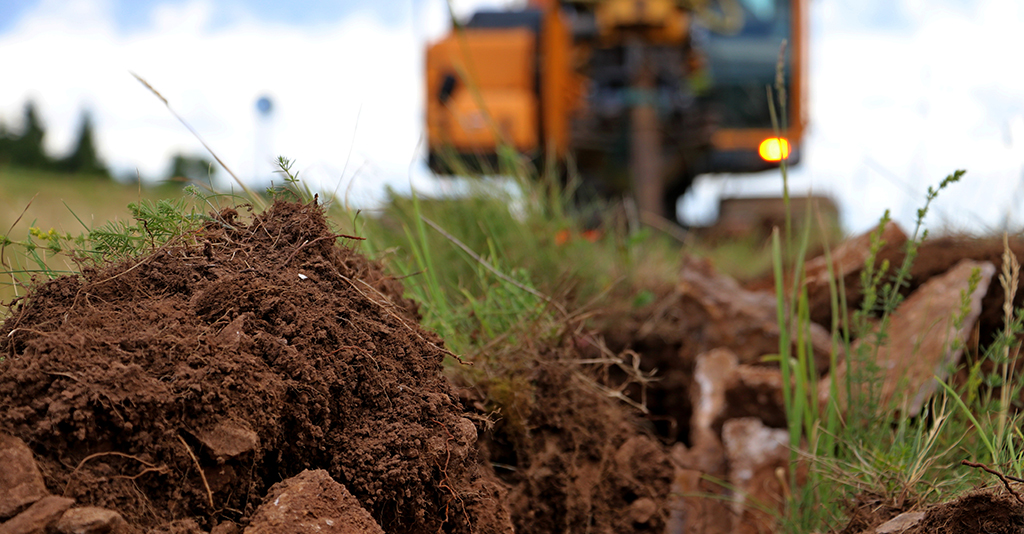
Geotechnical engineering is present in every construction project in some capacity. It involves the subsurface explorations, soil and bedrock testing, design of foundations and other underground structures, and construction monitoring which occur from the start of the project in schematic design, right through project completion. The extent to which field and laboratory soil and bedrock tests are performed depends on the site surface and subsurface conditions, contract requirements, local/state building codes, project complexity, and existing knowledge of the site. The geotechnical engineer is hired by the construction manager/general contractor, the owner, or any other party within the project team that requires geotechnical support services.
What are the benefits of testing, exploration, and oversight?
Geotechnical engineers perform soil and bedrock testing, subsurface exploration, and oversight within the field for several reasons including:
- Determine soil, bedrock, and groundwater conditions that affect project design and construction;
- Confirm the soil is suitable for design/construction;
- Identify potential project risks associated with subsurface conditions;
- Detect unexpected field conditions that may impact design and construction; and
- Confirm design/construction is being performed in accordance with the agreed-upon contract/bid/spec documents (quality assurance/quality control, i.e. QA/QC)
This testing and monitoring are especially important for project record-keeping because structures are frequently built slightly differently from the design drawings due to inevitable field condition changes that occur along the way—we can never 100% know what is in the ground (even with testing and exploration) and therefore oftentimes have to make design adjustments accordingly.
What is the difference between QA & QC regarding geotechnical engineering?
Quality assurance (QA) comes down to having a quantifiable test result. There are many tests geotechnical engineers can perform that produce factual, scientific information, that project teams can use to make smart project decisions and ensure the contract requirements are being met. For example, you can use a nuclear densometer to measure moisture content and density of soil. These test results can be used to determine if the ground is appropriately compacted and safe for building.
Quality control (QC) involves visual observation by the geotechnical engineer. For example, the engineer would observe the compaction of the soil to ensure it was done in accordance to contract documents. Observation of the compaction would serve as the evidence, rather than a test with a quantifiable result that was obtained by the nuclear densometer in the example in the paragraph above.
What other types of standardized tests, methods, and procedures do geotechnical engineers utilize?
There are numerous standardized tests that can be used including those from American Society for Testing and Materials (ASTM) International, American Association of State Highway Transportation Officials (AASHTO), and the Federal Highway Administration (FHWA), among others. The tests selected for use are typically based on state and local building codes, however, sometimes designers recommend going above and beyond the “typical” standard of practice for tests if they know from experience it would result in long-term cost savings for the project owner.


How do geotechnical engineers know how large of an area of soil needs to be tested and monitored?
That is one of the challenges with geotechnical engineering because no matter how much or how large of an area you test/explore, you can never know exactly what is going to be in the entire ground you are building upon/through, etc. A test/exploration might involve drilling a four-inch diameter borehole to collect samples of the subsurface materials. With that borehole, you typically drill down to a pre-determined depth or a depth influenced by encountered subsurface conditions that deviated from assumptions. If it is natural soil through-out depth, you might assume that you will also find generally the same material from within that hole in the rest of the area you are building your structure. However, subsurface conditions can vary dramatically across even a small project site. More boreholes or other methods of exploration/testing (i.e. test pits, geoprobes, CPTs, etc.) would help you better define the subsurface profile, but there is always a possibility that the subsurface outside of the exploration/testing locations varies significantly from what was visually observed.
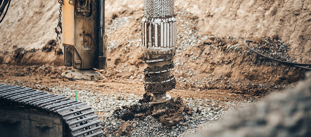
Undocumented manmade fill is different than natural soil because you most certainly never know what you are going to encounter (e.g. boulders, brick, concrete, debris, loose material, etc.). Due to the uncertainty of the undocumented fill, most projects require the removal or improvement of the fill within the proposed building limits and under other load bearing structures. This is because the properties of the undocumented fill are typically very heterogeneous and may not be similar as the properties encountered in the exploration/test location. Exploration and testing can help determine the estimated extent (depth and area) of the undocumented fill to mitigate the risk of change orders from unexpected fill removal during construction.
How can you know that ground is starting to settle, and therefore, do something about it?
Geotechnical engineers can use a system of instruments such as inclinometers, survey monitoring points, piezometers, extensometers, or settlement plates. For instance, inclinometers might be installed behind an excavation support wall to measure how much the wall moves due to excavation. Movement of the wall inward towards the excavation means that there could be a loss of ground behind the wall and therefore potentially settlement. The measurement from the inclinometer is important for engineers because they know how much the excavation wall can move before damage to surrounding structures such as cracking pavement and building tilting/settlement occurs. Damage can be caused by as little as 1-inch of movement. If too much movement does occur, work can be paused so a solution can be executed prior to damage to surrounding structures.
So, all in all, geotechnical engineering is important then.
Yes! Geotechnical engineering helps to ensure that structures are built right. Once things are built into the ground and covered by backfill, you cannot see if the proper subsurface preparation was performed for the structures. So, if you cut corners with your geotechnical engineering or earthwork construction, you can run into significant issues either immediately or several years down the road such as structure cracking, settlement issues, loss of ground, and a whole bunch of other very expensive problems.
How has your background in geotechnical engineering helped you to become a better owner’s project manager?
Although I wouldn’t call myself an “expert”, I do have a master’s degree in geotechnical engineering and provided those services with past employers for five years. In my past roles, I worked in different aspects of geotechnical engineering; from site observation and design to more technical work supporting litigation and claims. With my understanding of geotechnical engineering, construction, contracts, and permitting, I have a better understanding of what projects need in terms of these services. I can leverage this knowledge for PMA project owners to help guide projects in these areas, providing another layer of expertise that leads to projects finishing within budget and schedule.
 Cody Gibb is an owner’s project manager with our Boston team currently supporting several municipal building projects. He has a bachelor’s degree in Civil Engineering from Wentworth Institute of Technology and a master’s degree in Geotechnical Engineering from the University of California Berkeley. He is a member of the American Society of Civil Engineers (ASCE), the New England Healthcare Engineers Society (NEHES), and is a former Chair of the Engineering Management Group of Boston Society of Civil Engineers (BSCES).
For more information about PMA Construction Management, Project Risk Management, and Construction Claims services, please contact info@pmaconsultants.com.